Stop #42: West Quoddy Peat Bog

Location:
West Quoddy Head Road toward Quoddy Head State Park. On the mainland side, West Quoddy Head Road traverses a peat bog along a narrow strip of land.
N 44°48’40” W 66°58’54”
Geology:
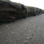
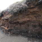
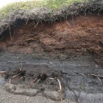
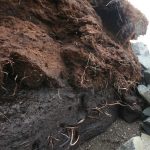
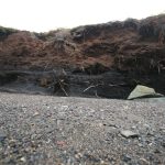
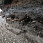
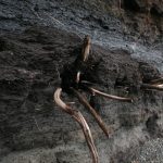
Peat Bog: The sphagnum peat bog along which the road traverses is badly eroded along the north side. The beach rests on the glacial marine mud.
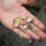
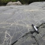
Based on radiocarbon dates on lowest available peat exposed on the beach, it started to form about 11,400 years ago. Fossil mollusk shells are commonly present along the lower area of the beach below high tide, having eroded out of the underlying mud. These include the Greenland Scallop, which indicates arctic marine conditions as the glacier margin retreated inland about 15,000 years ago. Toward the east along the beach, the wave-cut bluff exposes the marine mud overlain by beach sands and fine pebble gravels. This section demonstrates a history of land emerging from the sea. The drop in sea level caused the water to become shallow, and coarse beach sediments were deposited on top of the mud that had previously accumulated on the ocean floor. Then the peat bog began to form after the ocean receded. Further along the beach, a bedrock outcrop is being exposed by wave erosion. It shows well preserved glacial striations and fine polish on its surface, the striations indicating ice flow toward the southeast.