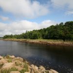
Stop #31: Downtown Machias – Sea Level Rise


Location:
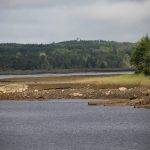
Downtown Machias, Bad Little Falls Park. Below the falls, visible at low tide from Bad Little Falls Park and parking areas behind local businesses on Route 1.
N 44°42’49” W 67°27’14”
Geology:
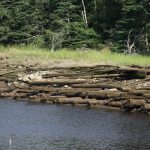
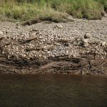
Sea Level Rise: These former working waterfront docks, built around 1875, were used into the 1930s. The working surface is now underwater at high tide. This represents a rise of at least 2 feet and as much as 5 feet since 1875, based in part on historical photographs. The presence of the salt marsh above the working dock surface clearly demonstrates sea level rise