Stop #21: Historical Survey Marker – East Base
Location:
Northeast of Cherryfield on Pea Ridge Road. Approach from either Cherryfield or Columbia Falls.
N 44°40’08” W 67°49’57”
Geology:
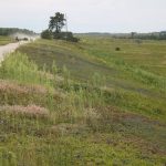
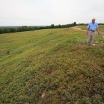
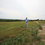
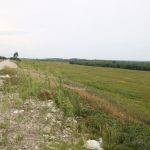
Historical Survey Marker: This is the outer seaward edge of the ice-contact delta, at its eastern end. Just to the north, the line of trees and scattered large boulders mark the ice-contact position. From this location, the delta was built to a sea level approximately 250 feet above the present level. This edge of the delta displays one of the best examples of an elevated shoreline in the United States. The prominent shoreline is composed of the 20-foot wave-cut bluff and terrace, visible just below the road. The boundary between the two approximates the storm high-tide level. Below this is a descending series of beach ridges, offshore bars and subtle wave-eroded scarps formed as the sea level dropped. The landforms seen here are exceptionally well preserved. High, prominent shoreline exists on similar deltas along coastal Maine and New Brunswick.
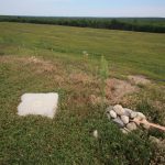
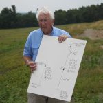
Just off the roadway is a square granite base. This is a remnant of the 1853 monument marking the east end of the 5.5 mile-long Surveying Base Line Number Nine, at Epping. The 4.5-foot-tall marble obelisk that rested on this base has been destroyed. The other obelisk, marking the West Base of the line, is preserved in the Maine State Museum in Augusta. This line, measured within a fraction of an inch between two precisely located horizontal markers, was established in 1853 by the U.S. Coast Survey under the directorship of Alexander Dallas Bache, Benjamin Franklin’s grandson. Once accurately determined, the line served as the basis for establishing benchmarks for the mapping of the region by the triangulation surveying method.
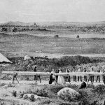
The black and white image, featured left, is a scene during the survey of the base line in 1873. The distance of the line was measured with calibrated steel rods which were kept at a near constant temperature by insulation material seen in this lithograph.
Note: This is private property. These are commercial blueberry fields, do not walk on the blueberry fields, or pick berries. You are fully responsible for your own safety and for any damage to your property, and that of the owner by you while on site. Dirt roads are not suitable for large RVs.