Stop #20: Glacial Contact Edge
Location:
Northeast of Cherryfield on Schoodic Road, where the road abruptly turns west. Approach from either Ridge or Pea Ridge Roads.
N 44°41’28” W 67°50’54”
Geology:
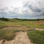
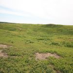
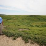
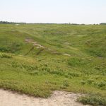
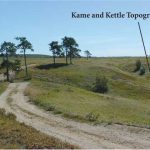
Glacier-contact Edge: This is the contact zone between the glacier margin to the north and the delta to the south. Here the meltwater streams discharged sediment into the sea, starting to build the delta. When the deposit built up to sea level, the meltwater streams continued to transport sediment from the ice seaward to the delta’s edge as it prograded on the sea floor. In this process, separated wasting ice masses were often buried by coarse sediment along the glacier margin. After the ice margin abruptly started to recede northward due to the warming atmosphere, the insulated, buried ice masses eventually melted away and the overlying sediments collapsed, producing hills and holes, also called kame and kettle topography.
Clearly the internally active ice margin remained in the position for a “long” time in order to build this delta. It then abruptly retreated leaving an ice-contact shlope along the north edge of the delta. This is evidence of an abrupt climate warming.
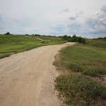
Note: Other than the roadway, this is private property. These are commercial blueberry fields. Do not walk on the fields or pick berries. Dirt roads are not suitable for large RVs.