Stop #12: Franklin Ice-Contact Delta
Location:
Visible from Georges Pond Road. Route 182 in Franklin to Georges Pond Road.
N 44°35’39” W 68°12’55”
Geology:
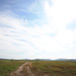
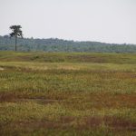
Franklin Ice-contact Delta: This flat-topped deposit of sand and gravel is a marine delta formed along the glacier margin by the discharge of a sediment-laden meltwater stream. The 250-foot elevation of the outer edge of the delta documents the sea level at the time of formation. A prominent marine shoreline composed of a wave-cut cliff and bench can be clearly seen on the south-—and southwest—facing front of the delta crossed by Route 182. It represents a falling relative sea level that temporarily stabilized at an elevation of about 230 feet. Note the large boulder accumulation and kettle hole topography along the northern edge of the delta. These ice-collapse features identify where the delta was built against the ice margin.


